Southwest Section of Big Bass Lake


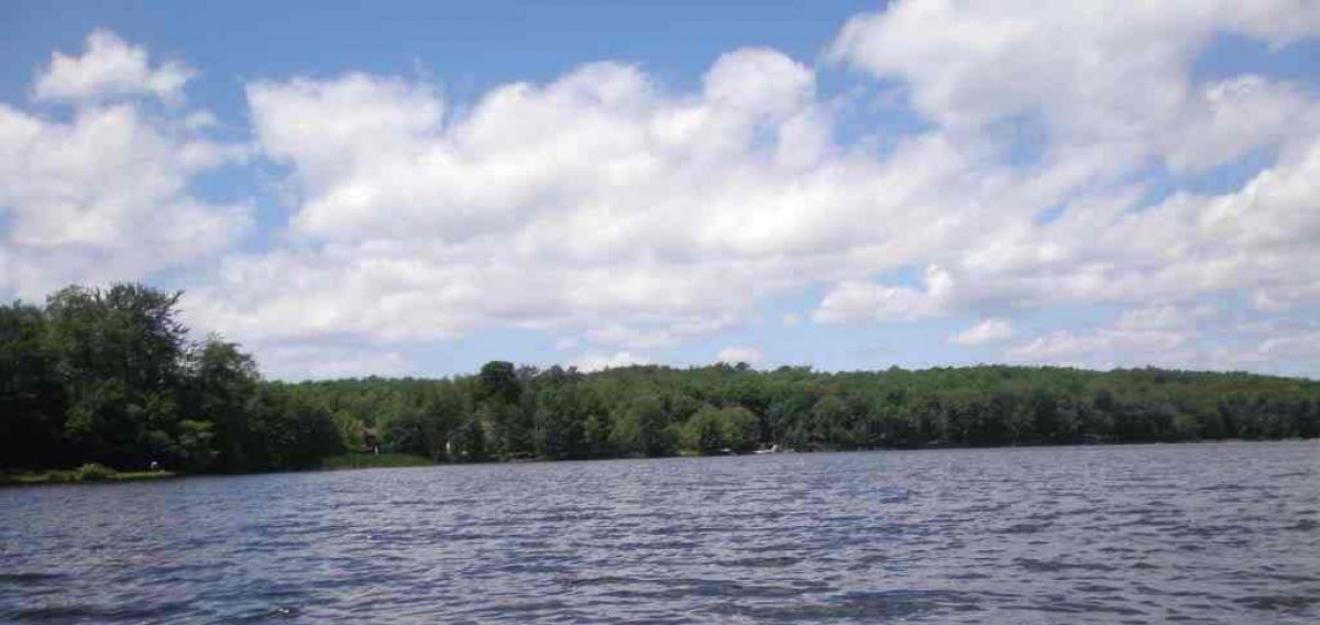
This photograph was taken off our former property on Big Bass Lake and provides you with the southwest corner of the lake.  Just to the right of this picture are the Public Landing and the Big Bass Lake Campground.  You can also make out the southern tip of Haunted Island. 

Just past that tip and due east is the Big Bass Lake Bridge leading to The Big Island.  And this location is where speedboats make their turn back northward around the eastern half of Haunted Island heading back toward the narrows or an eastern swing to the southeast portion of the lake.

Before the public lading was installed fishing was quite good in that area just to the right of this picture.  And about two hundred yards to the left of this location was our wooded beach area where the majority of my Boys Clubs of America camping trips were held. 

Are you Stressed?


And my thought for today is this is your just desserts! My favorite sweet at Big Bass Lake was powdered sugar donuts from the Big Bass Lake store. That was such a treat and I swallowed all that down with a refreshing bottle of Squirt. For those not in the know that is a grapefruit soft drink. That will take care of your stress any day of the week. Or you could just take a swim in Big Bass Lake.

Big Bird at Big Bass Lake


Big Bird here and I’m about to take off. The control tower has giving me clearance and I’m off to check out this lake. Haunted Island doesn’t look too scary to me and from up here the Big Island doesn’t look too big either. Tiny Tim is definitely tiny and Turtle Island rather scares me. It looks so foreboding. Now Four Winds Island looks like a fun place for me to camp for the night. Oh, it used to be a camp? Well it’s about to be a camp again. After all birds of a feather should stick together. I’m a poet and don’t even know it.

Quickie Pies From The Big Bass Lake Store


pies_1

With all the emphasis on pie recipes lately, I have to say that pies were also a favorite of the kids that came to our property. But Hostess played the key here. The Big Bass Lake Store was where the kids stocked up on their favorite pies for snack times later in the day or even on a hike.

Here they could find peach, apple, blueberry, and cherry pies along with several other flavors. I have to admit that I enjoyed them too. The only recipe these boys needed was on how to unwrap their pastries in order to gobble them down.

The Big Bass Lake Store was a favorite place for the kids to go for their snacks and soda pop which gave them a break from Trail Pack foods that we used at our family wooded beach. However the boys did learn to make their own jelly once to top off cattail pancakes and that flavor was blackberries that they gathered themselves from our blackberry bushes just off Noreika Road.

The Wabash / Big Bass Lake Connection


There is a connection to Big Bass Lake, irons, Michigan and Wabash, Indiana. The link is Ed Hawks of Big Bass Lake who’s engineering firm was contracted to do the job in the restoration of downtown Wabash many years ago. This was before Ed and I knew each other. It’s a Small World After All.

No, this isn’t Ed Hawks but it is a Loon on Big Bass Lake. You know, I wonder why he’s not on Loon Lake? Not Ed, The Loon. I have a hunch this post is going to end a little Looney. Ed your company did a marvelous job in the restoration of downtown Wabash.

Fantastic M-37 Overlook


On the way to Baldwin, Michigan, a few miles south of Wolf Lake, is a gigantic hill where you can observe a dirt road in the distance weaving its way through the Manistee National Forest. It’s an incredible sight. Our photograph looks south at the summit of that hill on Michigan 37. If one were to be traveling north, there are two lanes going up that hill and in your rearview mirror you could still observe that sandy trail snaking its way through the forest.

Last year I had a business conference in Traverse City and chose to drive up taking M-37 out of Grand Rapids. The roughly ninety mile drive was all forest from that point on. On the way home, I was able to stop and take this photograph of the snake like road in the distance all of sand.

I’ve always loved the summit where you can see for miles through the Manistee National Forest. In this picture you can barely make out that sandy road but it is there. This is about sixteen miles from Big Bass Lake.